Stream Restoration & Management | Limnology & Lake Management
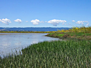
Wetland Restoration and Management
Charleston Slough Enhancement Plan. For the City of Mountain View, 1991-00. This project involved extensive modeling with a tidal hydrodynamic model to design a solution for enhancement of inner Charleston Slough, review of construction plans, and monitoring of post-construction hydrologic conditions The modeling included calculation of tidal flows with various culvert configurations, calculation of bed shear stress and analysis of potential channel scour, and modeling of potential sediment deposition in the inner slough area. The latter was carried out using dredging data from Palo Alto Yacht Harbor to calibrate the sediment deposition model developed by Dr. Ray Krone. The project included participation in a number of meetings and hearings at BCDC. The project has been constructed and is working successfully. Since 1998, Coats has been assisting the City of Mountain View in its monitoring program at Charleston Slough.
Review of the Bolsa Chica Lowlands Restoration Project. For the U.S. Environmental Protection Agency, San Francisco, 2000. Eight state and federal agencies have proposed a project to create a new ocean entrance at Bolsa Chica, in order to enhance the diked wetland and off-set habitat loss at the Ports of Long Beach and Los Angeles. Coats assisted EPA with its review of the EIR/EIS and related technical documents, incorporating input from two experts in water quality and sediment transport modeling.
Peacock Lagoon Water Quality Study. For Peacock Gap Golf Course, 2000. Hydroikos, together with Tom Burke and Robert Abbot, evaluated water quality and circulation problems in a salt water lagoon that receives runoff from a golf course and residential development. The team developed a detailed water quality monitoring program for the lagoon.
Wetland Compliance and Mitigation. For the Cline Vinyard, Sonoma, 1995. The client modified drainage on a parcel adjacent to Sonoma Creek by installing a new culvert, an action considered by regulatory agencies to be a violation of Sec. 404 of the Clean Water Act. Coats helped find a solution to the problem by modeling the previous, existing and mitigated conditions on the site. The mitigated condition included culvert modifications to enhance wetland conditions on the site.
Design Guidelines for Channels in Tidal Wetlands. For the US Army Corps of Engineers Waterways Experiment Station, 1994. Coats developed design guidelines and criteria for design of tidal slough channel, using an extensive data base relating channel width, depth and cross sectional area to tidal prism. Relationships were also developed for channel side slope, and channel planform characteristics, such as density, bifurcation ratio, sinuosity, etc.
Montezuma Slough EIR/EIS. For the Solano County Planning Department, 1993-1996. Coats prepared the hydrologic components for both the Draft and Final EIR/EIS on a project to create an 8,000 acre wetland using dredged material from San Francisco Bay. The work included: 1) supervising the use the hydrodynamic models DIVAST and ESTFLO to simulate tidal circulation and determine the likelihood of channel erosion; 2) using empirical geomorphic relationships to evaluate proposed design of main channels; and 3) evaluating potential water quality impacts of the proposed project. Many of the mitigation measures specified in the Draft document were incorporated into the final design.
Potrero Hills Wetland Enhancement at Hill Slough. For the Potrero Hills Landfill Co., 1994-96, through subcontract with RMI, Inc. Coats managed the hydrologic analysis for enhancement of a wetland at the eastern end of Hill Slough, as mitigation for unpermitted fill. The analysis included 1) measuring tide height in Hill Slough with a recording tide gage, and developing a statistical relationship with San Francisco tides; 2) modeling tidal flow through culverts; 3) developing runoff hydrographs and analyzing the potential effects on flooding of proposed enhancement of a seasonal wetland.
Enhancement Plan for Bennett Slough, at Moss Landing Harbor. For Moss Landing Marine Lab and State Department of Parks and Recreation, 1990. Following the destruction of Jetty Road in the 1989 earthquake, a routing model was used to design a tidal inlet to Bennett Slough, and to determine the height-duration relationships for various inlet alternatives.
Enhancement Design for the Blohm-Porter Marsh. For the Monterey County Planning Department, through ABA Consultants, 1990. The project developed a detailed design to manage the Blohm-Porter Marsh, at the head of Elkhorn Slough. The hydrologic analysis included developing runoff hydrographs for various frequency flood events, and routing the floods through the marsh against high tides. Design drawings and specifications for the selected culvert alternatives were prepared by a subconsultant.
Chabot Creek Marsh Flood Analysis. For the Vallejo Sanitation & Flood Control District., 1988-89. This project analyzed the flood hazard and constraints and opportunities for reducing flooding at Chabot Creek, near White Slough in Vallejo. The hydraulic analysis showed that a planned flood control channel across the marsh was unnecessary, and would not alleviate existing flood hazards. This conclusion saved the City of Vallejo over $1 million.
Concord Naval Weapons Station. Analysis of contaminant transport and site hydrology at Naval Weapons Station Concord, 1986-1991. This analysis was a part of the Remedial Investigation and Feasibility Study for cleanup of heavy metal contamination in tidal and freshwater wetlands. The investigation formed the basis for a successful lawsuit brought by the Navy to recover damages from parties responsible for the contamination. It also formed the basis for the remediation and monitoring plan. Coats testified in Federal Court as an expert witness for Dept. of Justice.
Evaluation of J-Pond Detention Facilities in Coyote Hills Marsh. For the Alameda County Flood Control District, 1993. Detention storage was modeled in a freshwater marsh system that receives runoff from residential portions of Fremont, Ca. The ponds included the DUST marsh, a demonstration marsh designed to remove pollutants from urban runoff.
Cuixmala Water Resources Investigation. For the Goldsmith Foundation, 1994. The Cuixmala Biosphere Reserve in Jalisco, Mexico, was threatened by a proposed resort/condominium complex. Coats worked with a team of ecologists from the National Autonomous University (UNAM) and the firm of LSA to analyze the impacts of the proposed development. He assessed the available water resources at the site; this included pumping tests on existing wells, streamflow measurements and analysis of existing water resources and hydrogeologic data.
Enhancement Plan for the Azevedo Marshes, at Elkhorn Slough. For the Nature Conservancy, and the California State Coastal Conservancy, 1992-93. With funding from the Port of Santa Cruz Mitigation Fund, Coats developed a detailed conceptual plan for implementation of the wetland enhancement plan developed previously by ABA Consultants. The work involved detailed topographic mapping and use of pond routing model to compare enhancement alternatives.
HARD Marsh Restoration. For Hayward Area Recreation & Parks District, 1986. Using a pond routing model, Coats designed the culvert and circulation system for abandoned salt ponds that had been isolated from tidal action by action of an adjacent land owner.
Hamilton Army Airfield Wetland Restoration. For the California State Coastal Conservancy, 1993. Coats reviewed the numerous planning documents for closure and realignment of Hamilton Army Airfield, and prepared a detailed scope of work for wetland creation on the landing strip parcel. The scope focused on the use of dredged material to raise the elevation of the site in order to create a tidal salt marsh.
Wetland Mitigation for Widening of Highway 37 at Vallejo. For Caltrans, 1993-1995. Coats analyzed hydrologic conditions and developed detailed conceptual plans for the wetland creation at the Guadalcanal Village site (formerly a part of Mare Island Naval Shipyard) and White Slough. The project included installing and operating two recording tide gages (on the Base, and at the project site), and using the data to calculate local tidal datums, and to model the deposition of sediment in the restored marsh. The work also included analysis of the feasibility of creating a new wetland near the mouth of Chabot Creek, and modeling of tidal circulation in White Slough.
Highway 237 Wetland Mitigation. For the Santa Clara Valley Traffic Authority, 1992. This project included: 1) screening potential sites to find one suitable for the mitigation project; 2) working with the biology consultants to develop objectives for the project; 2) measuring local tide heights at two locations in Guadalupe Slough; 3) developing alternatives, and analyzing them using a hydraulic model and measured tidal inputs; 4) developing grading plans and excavation estimates; and 5) designing and implementing a monitoring program for hydrologic aspects of the project. The project was constructed in 1992 and opened to tidal action. Preliminary results show that it is heavily used by migratory birds and has rapidly developed a cover of wetland vegetation.
Huntington Beach Wetland Restoration Plan (Talbert Marsh). For the Huntington Beach Wetlands Conservancy, 1986-87. Coats, in cooperation with Wetlands Research Associates and biologist Barbara Massey, developed a detailed enhancement plan for a 17-acre degraded formerly-tidal wetland at the mouth of the Talbert Channel. Hydraulic modeling included use of the 1-d estuary model MARSHFLO. Restoration of the site to tidal action and creation of a new sand dune were part of the required mitigation for widening of the Pacific Coast Highway. The Plan was presented in a public meeting at Huntington Beach in Nov. 1986, and accepted by all of the agencies involved.
Jurisdictional Determinations and Compliance Review. For the U.S. EPA Office of Wetlands Enforcement and Compliance, 1991. Coats assisted EPA in its determination of the line of "Ordinary High Water", and reviewed remediation plans, on several rivers in California and Arizona.
Kennedy Park Wetland Enhancement Plan. For the City of Napa Department of Parks and Recreation, 1989. Coats, together with Wetlands Research Associates, developed a plan for restoration and enhancement of wetlands and ponds along the Napa River. Analysis included use of a numerical computer model to analyze alternative culvert and grading designs. The project has been implemented, and is a success.
Laguna Canyon Lakes Enhancement Plan. For Laguna Greenbelt and the California State Coastal Conservancy, with Wetlands Research Associates, 1992. Coats developed the hydrologic elements of the enhancement plan. Work included analysis of flood control alternatives and developing detailed conceptual plans for water quality control, especially for nutrients and sediment.
Leslie vs. United States. For the U.S. Army Corps of Engineers, 1989. Coats analyzed the hydrologic conditions of the Coyote Tract, at Newark, in relation to a dispute involving wetland jurisdiction. The analysis included measuring tide heights on and near the site, modeling the ponding of water in a seasonal wetland and investigating conditions of capillary rise in soil near the water table. The work also included preparing and giving testimony in Federal Court.
Enhancement Plan for Roberts Landing at San Leandro. For the City of San Leandro and Citation Homes, Inc., 1990-94. Coats developed a detailed conceptual plan for enhancement of a 300-acre wetland complex, including muted tidal and fully tidal areas. The alternatives analysis included use of two different hydraulic models, calculation of bed shear stress and tide height-duration relationships. Construction was carried out in summer 1994; biological and hydrologic monitoring of the site indicates that the project has been highly successful.
San Rafael Canal Mitigation. For the U.S. Army Corps of Engineers, 1994.Coats supervised the development and analysis of alternatives for modifying the hydrology of two sites adjacent to San Rafael Canal, as part of the mitigation package for the Army Corps of Engineers flood protection project at San Rafael. The analysis includes modeling tidal flow using a numerical model, and expressing the results in terms of the percent of time that a given elevation is inundated. Alternatives analyzed include installation of adjustable tide gates, and the use of self-closing tide gates that will allow normal flow most of the time, but close during extreme high tides to provide flood protection.
Management Plan for the Springtown Alkali Sink. For the California Department of Fish and Game, 1988. The Springtown Alkali Sink is habitat for the Endangered plant Cordylanthus palmatus. In collaboration with two ecologists, Coats studied the hydrology and soil chemistry of the alkali sink, and developed a management plan for the area. The plan included designation of management zones, with conceptual development prescriptions for the zones.
Management Plan for Tahoe Yellow Cress. For the California State Lands Commission, 1990-92. Coats developed and wrote a management plan for the endangered plant Rorippa subumbellata, which is confined to the sandy shores of Lake Tahoe. He analyzed the hydrologic and soil factors related to the plant's distribution, and incorporated input from biology subconsultants on the plant's distribution and habitat requirements.
Mowry Slough Wetland Jurisdictional Determination. For the California State Lands Commission and State Attorney General's Office. 1993. Coats analyzed the hydrologic conditions and geomorphic history of a diked subsided wetland adjacent to Mowry Slough, in Fremont. Basis of the analysis was a detailed geomorphic map of an undisturbed tidal wetland at Newark Slough. This included cross-section surveys, tidal measurements, and (in collaboration with Ray Krone), 14C dating of plant remains in marsh sediments in order to establish the sediment deposition rate. The results were used in the development of design guidelines for tidal slough channels as well as in negotiating a settlement with the owner of the Mowry Slough tract.
Union City Marsh Enhancement Plan. For the East Bay Regional Parks District, 1993. The Union City Marsh is located on the southwest shore of San Francisco Bay, just north of the Alameda Creek Flood Control Channel (also known as the A-Line Channel). The area has been diked from tidal action for many years. Levee construction was probably carried out in phases; remnant levees run parallel to the channels in the marsh in some areas. Dramatic changes in the local shoreline have occurred, but the location of interior channels in the marsh has not changed much since the 1800's. For the project, Coats supervised the hydrologic analysis to evaluate tidal circulation for selected marsh enhancement alternatives, and to evaluate storage in the marsh during storm events. Modeling included use of HEC-1, ESTFLO (a 1-dimensional gradually varied flow model) and a pond routing model.
White Slough Enhancement Plan. For the City of Vallejo, through WESCO, 1990. Coats analyzed the hydrology of White Slough in relation to tidal flooding and storm runoff, using a pond routing model. The model results were used to analyze alternative culvert configurations for enhancing tidal circulation in the inner slough, while at the same time taking account of flood management constraints. The final report recommended (among other things) replacing the existing four damaged culverts with eight new culverts.
On-call consulting for BCDC. For the San Francisco Bay Conservation and Development Commission, 1981-1996. Coats provided on-call services to BCDC for 13 years, on a wide variety of problems concerning tidal wetlands around San Francisco Bay. Problems have included jurisdictional questions, and review of proposed mitigation and enhancement projects.
Hydroikos Ltd. e-mail: coats(at)hydroikos.com
Address available by request
Berkeley, California
Phone number by request